The Odoo 17 Field Service Module improves field service administration by allowing technicians to simply discover and browse customer sites.
In addition to allowing efficient scheduling, dispatching, and tracking of service activities, the Map View function enhances the client experience.
The module’s interface with Google Maps enables geolocation, route optimization, address validation, and map visualization of data stored within the Odoo system, improving functionality and user experience for businesses that depend on location-based services.
Features of Odoo's Google Maps integration include the following:
- Geolocation: Odoo users may quickly identify locations by entering addresses or coordinates.
- Address Validation: The Google Maps API ensures precise and complete addresses, which reduces customer data errors.
- Route Optimization: Odoo calculates optimal routes for delivery or service vehicles, lowering fuel costs and improving delivery times.
- Map Visualization: Users may visualize data contained in Odoo on interactive maps, allowing them to make more educated business decisions.
- Customization: Users can customize the Google Maps integration to fit their needs and branding.
- Real-Time Tracking: Google Maps integration allows for live tracking of assets, vehicles, or field staff, which improves operational efficiency.
- Integration with Other Odoo Modules: Google Maps integration can be combined with other modules to provide a full solution.
- API Access: The Google Maps API allows Odoo developers to create unique features and connections.
- Documentation and Support: Google and the Odoo community provide comprehensive documentation and development resources to provide successful implementation and continuous support.
Map View
This feature is also available in the Odoo 17 Field Service Module's "Map" submenu, accessed via the "My Tasks" menu. Users can then view the location of their scheduled onsite services.
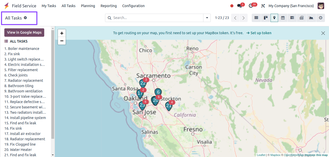
The image above displays a list of jobs and services organized by number. The map view displays the precise task position.
As a result, the designated employee and user can monitor the locations using this function, improving time management and ensuring that the operation is completed on time.
Detailed Task View
Click on the work number to see its precise location on the map. This will display preview details such as Name, Address, Customer, Phone, Worksheet Template, Activation Requirements, and customization, as shown in the screenshot below.
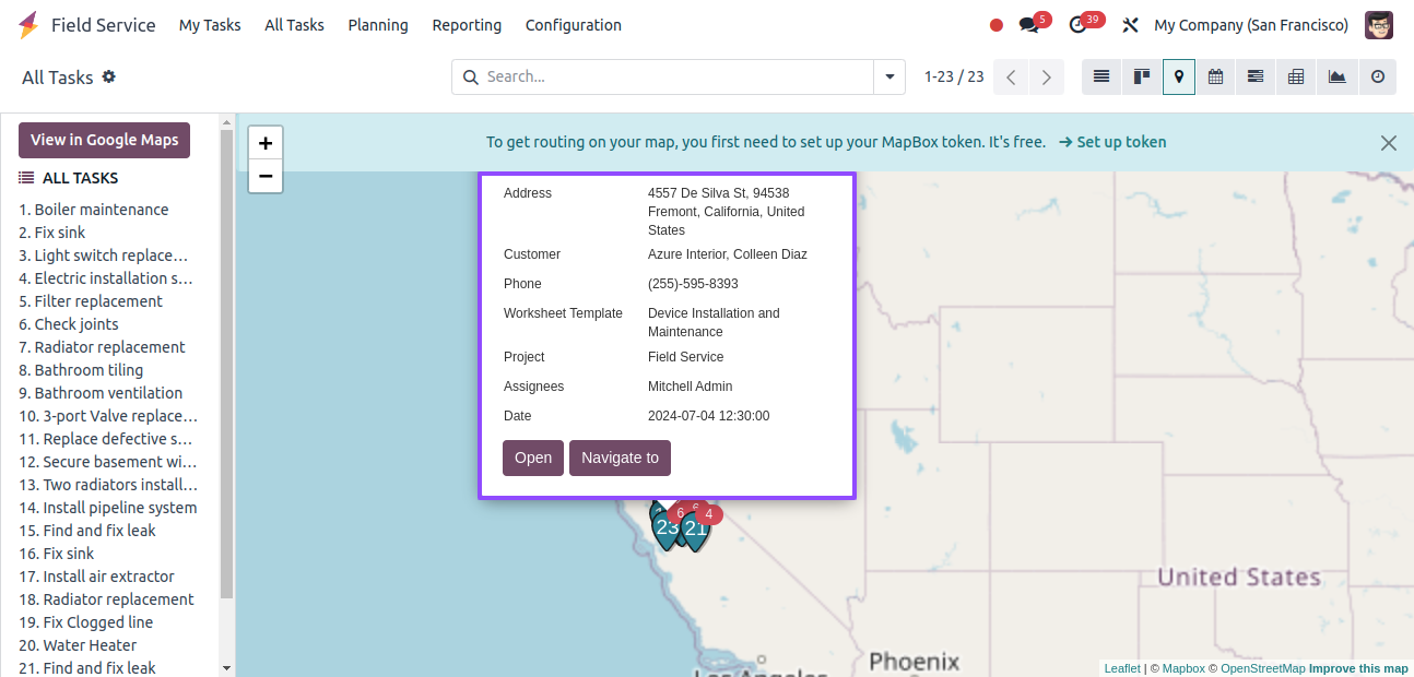
The ‘access’ button will access the detailed task form view, where we can control the project and task information, manage or update timesheets, and manage the subtasks, as seen below.
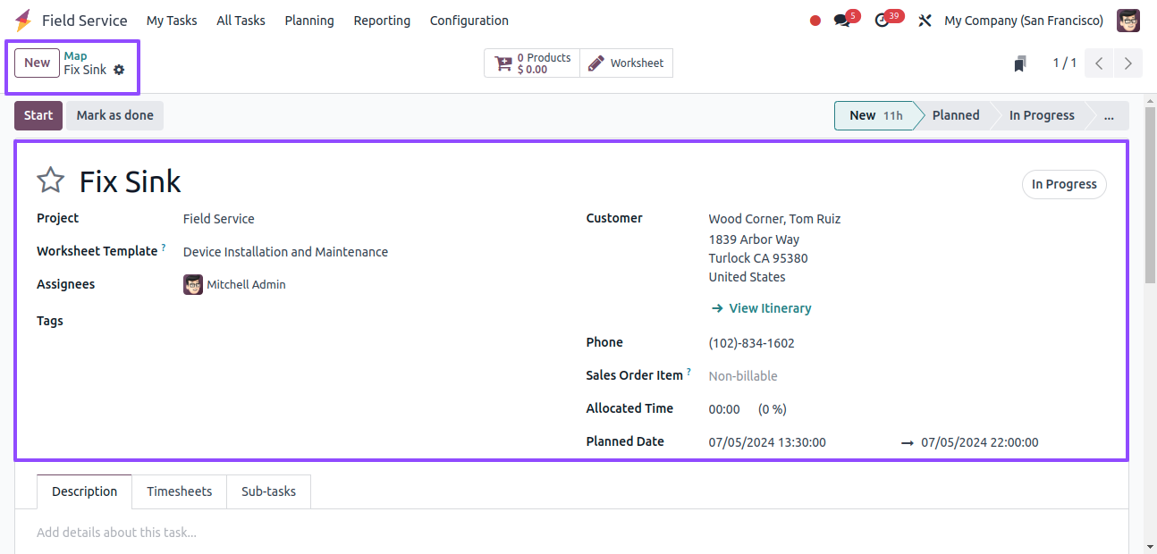
The Navigate to button will take you to the Google Maps window.
View in Google Maps
The View in Google Maps option displays tasks in a detailed Google Maps interface, as shown below.
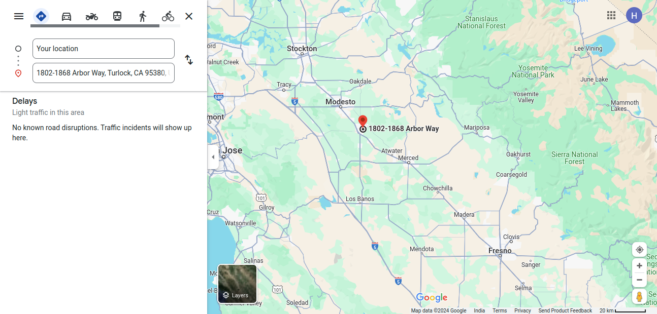
Google Maps view window, also known as InfoWindow, is a Google Maps API feature that allows developers to display more information when a user interacts with a marker or location on the map.
It enables content customization, dynamic data production, user interaction, and customization of the view window’s look and feel.
The Google Maps API supports event management, localization, mobile responsiveness, and accessibility for people with disabilities.
The view window can be used with other components to provide seamless navigation and analysis of geographic data.
This dynamic Odoo visually shows records on a map interface, making it easier to arrange journeys between activities in the Field Service application.
Zoom In and Zoom Out View
The "Zoom In" and "Zoom Out" important elements of map displays allow users to zoom in or out of specific regions or bigger views, which improves navigation efficiency. To see tasks in these views, utilize the + and - icons in the Map window.
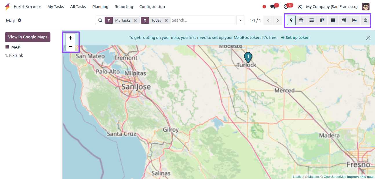
The map view can also be viewed in other visual representations such as Calendar View, Gantt View, Kanban View, Graphical View, List View, and Pivot View by selecting the appropriate icons from the upper right corner of the page.
Advanced Search Bar and Filters
The advanced search bar allows users to filter presented data on a map based on particular search factors.
It automatically changes the map display, providing autocomplete suggestions and extensive search options, as well as the ability to filter data based on different types such as My Tasks, Followed, unassigned, favorite projects, starred tasks, timesheets 80%, timesheets 100%, and so on, as seen below.
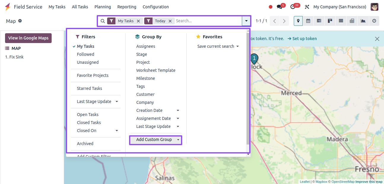
The Group By filters refine the shown data according to predefined categories or criteria such as Assignees, stage, project, worksheet, template, milestone, tags, customer, company, and so on. There are various uses for these filters.
We may add customized Filters and Group By options by clicking the 'Add Custom Filter' and 'Add Custom Group' buttons in the search box, respectively.
The Field Service app’s Map feature lets technicians plan their service routes efficiently using the Map view, ensuring that activities are completed on time and effectively across several sites.
The Map view feature in the Odoo 17 Field Service Module improves business operations by seeing customer locations, planning routes, and real-time location tracking, resulting in faster service delivery, lower costs, and higher customer satisfaction.

